Interactive map
To display neighborhood details on a map you can zoom in on, click on this link: Identifying Natural and Cultural Resources along the New Jersey Pilgrim Pipeline Corridor [courtesy the Spatial Data Center at Drew University]
Alternate route?
Pilgrim has drafted (but not formally proposed) a possible alternate route through northern New Jersey. See the alternate route page.
Pilgrim’s Only Public Maps for New Jersey
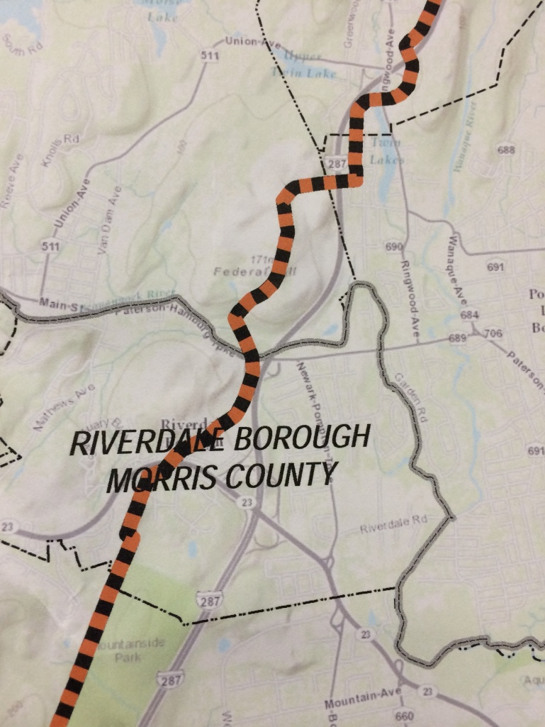
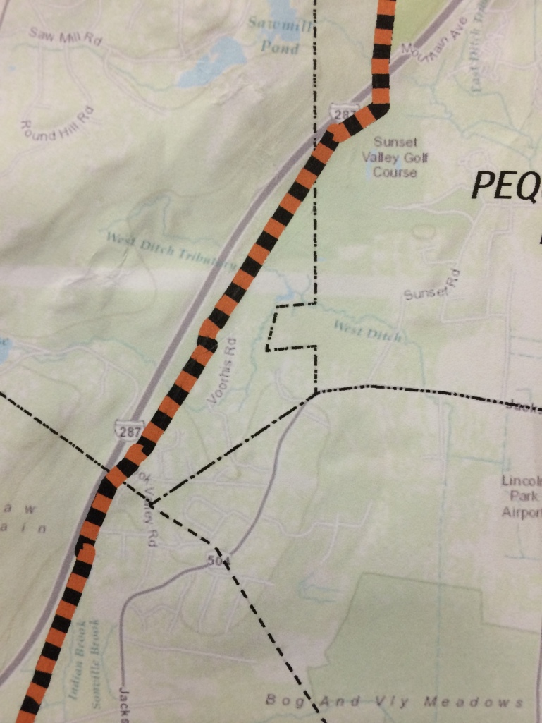
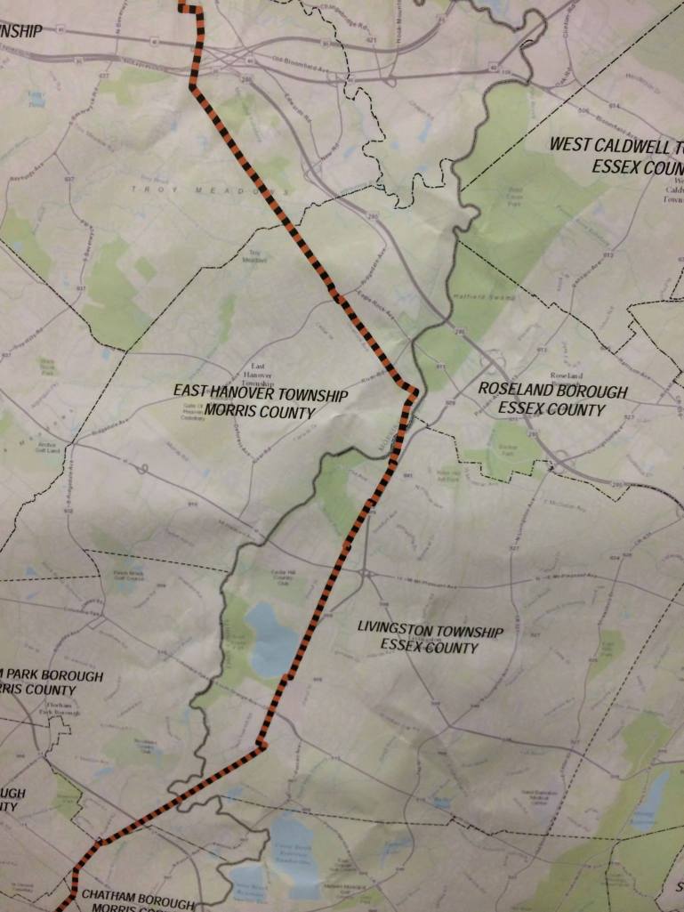
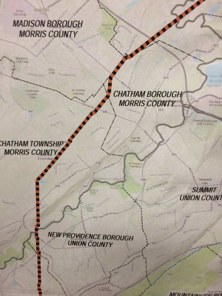
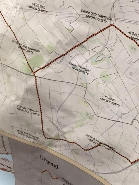
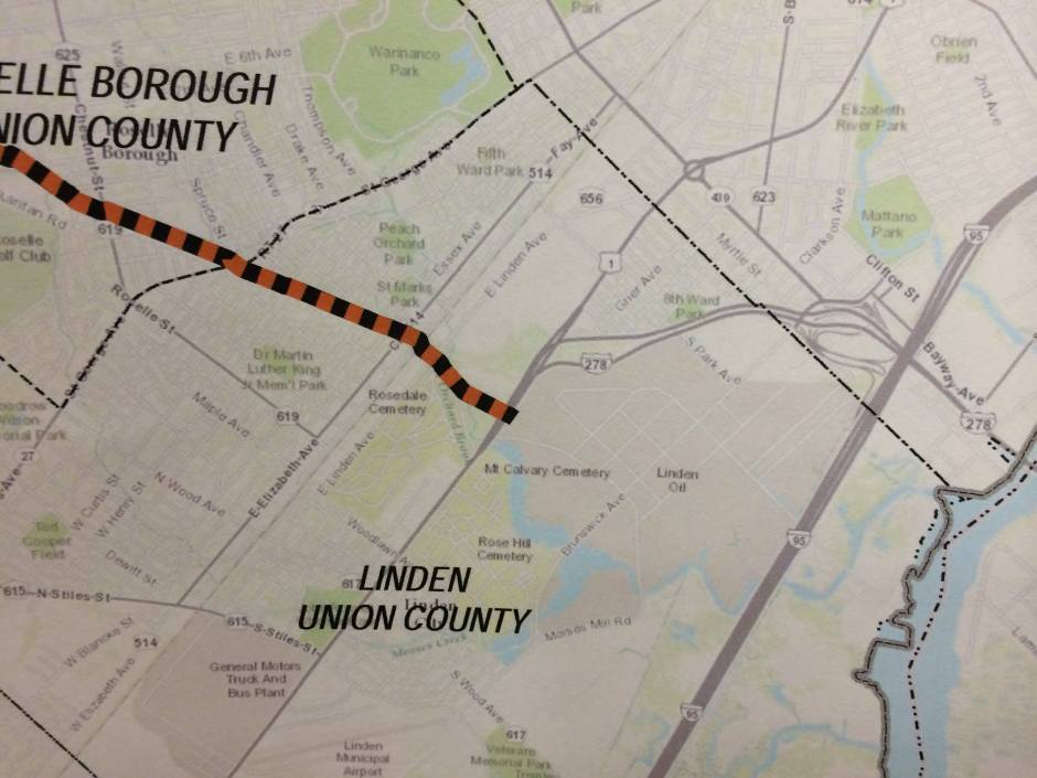
The following maps of the proposed route were presented by Pilgrim at a public session. These low-resolution photographs of that presentation were taken by a Coalition volunteer. Towns in bold have passed resolutions against the pipeline; towns in italics have not.
MAP 1: Mahwah

MAP 2: Mahwah, Oakland, Wanaque
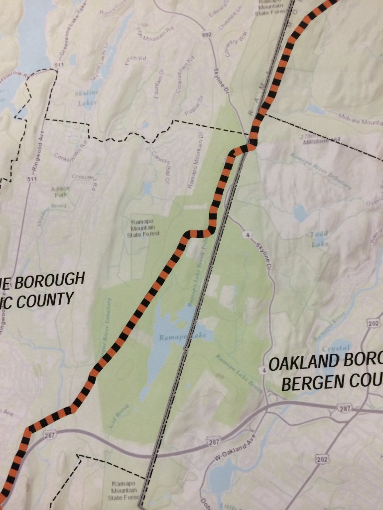
MAP 3: Wanaque, Pompton Lakes, Riverdale, Pequannock
MAP 4: Pequannock, Kinnelon, Montville
MAP 5: Montville, Parsippany-Troy Hills, East Hanover

MAP 6: Parsippany-Troy Hills, East Hanover, Livingston, Florham Park, Chatham Borough
MAP 7: Florham Park, Chatham Borough, Madison, Chatham Township, New Providence, Berkeley Heights
MAP 8: Chatham Township, New Providence, Berkeley Heights, Watchung, Westfield, Fanwood

MAP 9: Scotch Plains, Clark, Cranford, Roselle, Edison, Woodbridge
MAP 10: Roselle, Linden
These maps by a consulting firm describe the environmental impacts of the Project:
- Threatened and Endangered Species Along Pipeline Route
- Map of Pipeline Impacts on C1 Streams